A blog about all things car-free walking - taking the bus or train to explore the glorious peaks and valleys of the UK

18 October 2010

Looping around London

Walking boots, check. Scarf and woolly hat, check. Oyster card, check. Swipe card for work ... I'll leave that one behind today. It feels odd donning waterproofs on a weekday morning, but the occasional midweek day off is one advantage of working shifts. I decided to take advantage of the (admittedly weak) autumn sunshine to try out a car-free walk in London, ideal with its extensive public transport network.

A friend recommended the Pymmes Brook Trail but it was just a little too urban for me (and goes right past my house) so we decided to brave the world beyond zone three and devise my own walk, taking in part of the London Loop. As a nearby urban walk, it was also a good opportunity to test out what kit I really need, in preparation for more arduous routes where the nearest chemist is more than half a mile away. Compass, plasters, water and cash are always essentials; a good book and a banana protector are perhaps urban luxuries.

The familiar walk to the tube felt different, not just because we were wearing boots rather than smart shoes. It was the prelude to a day of fresh air and adventure, rather than another day in the office.

Cockfosters Station raises a titter among more juvenile Londoners, and has been doing so since the 16th century. The name possibly derives from cock breeding in the area, or that it was once the home of the chief, or cock, forester. The train was littered with discarded Metro newpapers, but instead my required reading today was OS173, which covers North London. Cockfosters wasn't the only name on the map to raise a smile; we also enjoyed the hilarious Ferny Hill, Rough Lot, Cuckolds Hill, and Noddin's Well, to which the response must be 'Really? I didn't know he was ill'.

The route began in the inauspicious surrounds of Cockfosters tube station cark park, and we'd gone barely 10 metres before the map and the compass were out of the 'essentials' list, for urban walks at least. The problem is the number of signs, buildings and landmarks, making it impossible to head west for 100m without walking into a wall. (For the record, turn right out of Cockfosters tube into the car park. There's a green gate on the left signposted 'London Loop', which takes you on to a path that circumvents the cemetery.)

Luckily, we were soon in open fields, woods and parkland, with the distant hum of the M25 largely drowned out by the cawing of crows, jays and magpies. While not the most exotic of species, it was a treat to see a variety of wildlife so close to my urban home, including wood pigeons, grey squirrels, rabbits, green woodpeckers, a crow the size of a chicken, great tits, a flock of starlings, a grey heron and three cock pheasants during the walk.

Passing an impressive, though deserted, children's playground on the right, we crossed into Trent Country Park. Stopping at the entrance cafe for a sneaky slice of carrot cake - another lesson learned for trickier walks: eat breakfast first - we then continued along the London Loop. It is no doubt busy at weekends, but we had it largely to ourselves this Wednesday.

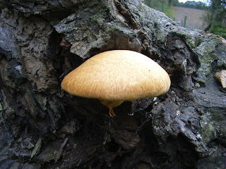
Passing lakes on the right, home to herons and ducks, we began the gentle climb up Camlet Hill. We made a slight detour north to see Camlet Moat, a 15th century island with a shallow moat where a drawbridge and weaponry dating from Roman times have been found. It's reputedly haunted, and is certainly eerie, not least because the algae covering the water makes the moat look like a road, and it would be easy to succumb to the water's depths on a dark night. The woodland surrounding the moat is rich in toadstools, including the fly agaric, easily recognisable to Noddy fans as Big Ears' home. We saw at least 10 varieties, enough for Noddy and Big Ears to climb the mushroom property ladder.

On exiting the wood, the path follows Salmon's Brook. The water still flows but is too shallow to harbour much in the way of fresh fish these days. The London Loop continues up Cuckolds Hill, but we took a detour north on a footpath alongside deeply ploughed fields to the Robin Hood in Botany Bay, a McMullens venue. More of a dining room than a pub, it was nonetheless homely and serves food from noon, making it a great spot for a late lunch (the carrot cake had long since worn off). It serves pub classics, plus a large chargrill and fish menu, platters to share and at least three hot vegetarian choices.

The Ridgeway which leads out of Botany Bay towards the outskirts of Enfield is the least attractive aspect of the walk, (nb you can catch bus 313 here to and from Potters Bar) as the road is busy, picking up the traffic turning into London from the M25 and the North Circular. But the ridge provides good views, with the television mast at Alexandra Palace and even the towers of Canary Wharf clearly visible to the south.

The road dips and climbs, and just beyond the Royal Chase hotel we rejoined the marked path, which heads north to Rectory Farm, home to some timid bullocks and friendly horses, and the red house, then under a railway bridge. You can extend the walk by heading north from St Johns church, but instead we opted for a leisurely pint in the quiet but welcoming Fallow Buck, and were treated by a couple of jays noisily flapping about in the trees opposite. We meandered through the estates to Gordon Hill train station for a short ride home, pitying the commuters surging out of London in the opposite direction. Pubs, walking and some urban wildlife - a perfect London day off.
Words and picture by Penny Woods

22 July 2010

What’s on the rocks?

Four miles of road walking. Doesn’t sound a great day out, but I’m not the only one trudging the tarmac along the Arisaig coast road. At each small bay and cove, people with cameras and binoculars peer expectantly out to sea. And with good reason … this is one of the UK’s otter hotspots.

The sun is shining – particularly fiercely for a Scottish May – and the sea lochs are shimmering, bright against the peaty brown headlands and islands. It’s a particularly fine stretch of coast, even set within the fierce competition of the west coast. And the tourists are flocking to this corner of the country – business in Mallaig has apparently boomed since the West Highland Railway started promoting day trips to the town from Fort William. The train journey through the highlands is rightly the major attraction, and with ninety minutes to kill in Mallaig (no easy task, I can tell you) they pack into the tea rooms and pubs.

After an hour of waiting, it’s clear the otters aren’t playing ball. Flask empty, newspaper fully browsed, I set off along the coast road again. At Millburn Cottage, I cross the stile and head along the deer tracks to Cruach Doire an Dobhrain, the high point of the Arisaig peninsula.

As summits go, it’s pretty modest – 103m. But the ground is rough going, with no tracks and plenty of heather. After an appreciative gaze at the Rois-Bhein hills to the south, and Rum and Eigg out at sea, I pick my way through the knee-high heather towards the coast, and the peninsula’s more reliable attraction – the remote bay of Port nam Murrach.

If this striking bay was on England’s south coast, it would have the full works – pubs, tea rooms, gift shops, overflowing car parks. Fortunately, it’s 40 minutes away from the nearest parking spot, which seems to be sufficient to keep most people away. Revelling in the solitude, I lie back on the sand and doze for an hour as the waves lap against the surrounding rocks. Balls to otters, this is the only way to spend a treasured sunny day in Scotland.

Returning via the cow-created track past Rhue Cottage, I get my wildlife spotter’s badge for the day – a buzzard circling over Cruach Doire an Dobhrain, with lapwings bobbling about in the nearby field. Heading back along the coastal road, several otter-spotters are still patiently sat by the shore; but for the furry beats are still proving elusive. I head past them towards my tent in Keppoch, via the restorative comforts of the café in Arisaig.

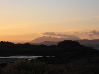
Even in May, Scottish evenings are long, and for those under canvas there’s little chance of sleep much before 11pm. But a long evening is no hardship when my campsite overlooks the islands of Skye and Rum. With the scarlet sun setting behind them, they looked perfect. If I was a Tweeter, I could have made lots of people envious at once, but as it was, I made do with a few texts before heading for the tent and the stove.

Eat and drink
Various cafes in Arisaig (although based on my experience, I would avoid the Rhu café). There’s also a small supermarket.

Sleep
several campsites around Keppoch – take the track past Keppoch house just north of Arisaig and follow the coast around to the campsites.

Getting there
Trains between Fort William and Mallaig stop at Arisaig, ten minutes from the village centre. There are also local buses that call at Arisaig.
Words and photos by Tim

1 May 2010

Getting away from them all

I go walking to get away from other people. Not completely – a cheery ‘hello’ is always welcome, as is a good walking partner (i.e. one who doesn’t talk too much) – but, like many walkers, I want to avoid the crowds. I want to ‘get away from it all’, ‘head off the beaten track’ and other such clichés.

The problem is that walking is too damn popular these days. Everyone’s at it – old, young, fat, thin, Duke of Edinburgh groups, Ramblers, people trying to get fit, groups raising money for some charity or another – and the great outdoors is taking on the characteristics of our busy day-to-day lives; noise, hustle, and even more bustle. I have seen walkers searching for a space to sit down at the top of Helvellyn, and (from a distance, fortunately) people queuing to go along Crib Goch – madness. I have even heard pub discussions about whether to limit numbers on popular hills – it works in New Zealand, after all. But how would that work – bouncers at Pen-y-Pass? 'Not going up in those boots, Sir.'

It can be immensely frustrating, especially if, like me, you share that sense of entitlement found in many regular walkers – that these people really shouldn’t be there, that I was there first, and they should respect my privacy by finding a different pastime. But there are ways around this irritation.

The first would be to try being a bit less antisocial. But let’s skip that one for now. An alternative is to pick more obscure, unknown hills. They can still be found, even in the Lakes or the Yorkshire Dales – you will rarely find a soul on Black Combe, for example. But then there’s a reason why peaks like Helvellyn are popular – it’s because they’re good, they’re dramatic, they offer the most exciting challenges. So it takes a bit of careful planning to get them to yourself.

Setting off early afternoon is a pretty simple trick. Catch the last bus or train of the day to your hill of choice, and you’ll arrive just everyone else is heading home. I have had the unrivalled experience of enjoying the summit of Snowdon by myself, on a sunny summer weekend, without a soul about except for the crows and seagulls feasting on the remnants of 1001 packed lunches. Heading up at 3pm, I passed the many hundreds of walkers, oozing down the Pyg Track and Miner’s Track like treacle, with only a few curious glances for my troubles. By the time I reached the western edge of Glaslyn, they had all vanished. Perfect.

On a mountain like Snowdon, with clear tracks to follow, it’s easy to plan for the walk down in fading evening light. Another way, and useful for trickier summits, is to camp out wild in the hills. This has the added advantage of getting them to yourself again the next morning, before the hordes begin their march. Nothing beats a cup of tea brewed as the sun goes down behind your favourite peak, when there’s not a sound apart from the gentle crash of a stream or the birds overhead. So if you can’t beat them, avoid them – it’s not always as hard as it seems.


Posted by Tim

25 February 2010

A Scottish winter wonderland

During the winter months in Scotland, the weather can change hourly and only a fool would pre-empt the forecast more than a day in advance. However, on this occasion, good luck was the reward for some advanced planning and the three of us were provided with some of the best mountain days ever experienced. Our adventure took place over three days, journeying where our curiosity, heavy packs and the avalanche warnings would allow.

Starting from Corrour Station, we passed the shores of Loch Treig to the valley of Allt na Lairige and an overnight stay in the bothy at the foot of Stob Coire ne Ceannaine. A sharp frost left us languishing in our bunks a little later than planned, but we did at least surprise the locals passing by; they proclaimed their astonishment that southerners such as us had braved the plummeting overnight mercury!

Departing after a warming breakfast of tea and packet porridge, it was not long before layers were shed due to the warming blue skies and the stiff climb to Stob Ban. From this lofty peak, we could view the stunning ridge above the Grey Corries and, confident that snow conditions would allow a safe passage, this was where we headed - an incredible traverse along the line between Stob Coire Leith and Stob Coire an Laoigh.

Choosing our line of descent carefully, we dropped into the valley of Allt Coire Rath, under the watchful eyes of a large herd of deer. A tricky river crossing required caution under heavy loads and tired limbs as the day's walking finished along the frozen banks of Abhainn Rath. Our second, and much needed, night of rest was spent at Maennanach bothy.

On paper, Day 3 could have been quite an undertaking - an 18km walk out along the length of Glen Nevis. However, with snow the consistency of caster sugar, walking was as effortless as one could hope for and under a cloudless sky of the deepest blue, we strolled through the valley, stopping occasionally to savour the silence and the most wonderful ice formations that lay on all sides.

With a head count of only six other people encountered during the whole trip, it was a with a little regret that we emerged back into civilisation. The feeling was strong that we might never enjoy such good fortune as this for a while. But then, the sun always shines on the righteous . . .

Getting there
The overnight sleeper train from Euston dropped us in the heart of the mountains at 9am. Our berths were £60 pp, booked in advance, though it is possible to get them cheaper via the Bargain Berths website. Our return from Fort William was made during the day, dispersing to various parts of England's south coast for a little under £30. However, a turn-up-on-the-day ticket would have set us back close to five times that amount!

Where to sleep
If you don't know about them already, you really must join the Mountain Bothy Association. They take care of a wide variety of shelters in the upland areas of the UK, and rely on the support of their members (both financial and otherwise) to provide this fantastic resource. Prefering a softer bed and shower before the train journey home, we opted for a last night of comfort at Glen Nevis YHA.

Staying safe
While the summer is midge season in Scotland, the winter hazard of avalanches is far, far greater. Before travelling into the mountains, be sure to get the latest updates from the Sport Scotland Avalanche information Service.

Posting by Gary
Photo's by Matt
M

You can view more images from the trip on our Visitor Review site.
For 100's more Car Free Walking routes in England, Scotland and Wales visit www.carfreewalks.org

5 February 2010

The lost village of Imber

We had finalised our plans the night before, sat in front of a blazing fireplace. Up early next day, quick cup of tea, then boots on and straight up on to Salisbury Plain, a ten-mile stomp and back home mid-morning for breakfast. This schedule would allow us to enjoy Wiltshire’s vast chalk plateau in near solitude, before the hordes of walkers, cyclists and rangers arrived. Hopefully we would see plenty of the wildlife that abounds on the lush, undisturbed grasslands and copses.

Standing outside at 6am on a freezing January morning, the flaws in our plan became apparent. My caffeine requirement correlates sharply with how early I rise, and the one cup of tea so far (cup, mind, not mug, and a smallish one at that) had barely raised a flicker on my internal motor. Danny, my walking companion for the day and someone I have long suspected to be of a much sturdier ilk, was thriving in the early morning darkness. Dermot the dog has unbounded energy at any hour, especially when there are rabbits about.

But our efforts paid off. Salisbury Plain is always a rewarding place for a walk, but it particularly inspiring at this early hour. The near-full moon shone brightly, illuminating the footpath, and the overhanging grasses tinkled as we crashed through their frost-covered seed heads. Soon we reached a barred gate that marks the perimeter of the army land. This is usually the point to turn left or right and head home via the outskirts of the plateau. But today, like a handful of other days each year, it marks the boundary of something a bit special. Our target was Imber, a deserted village right in the centre of Ministry of Defence land. They open it to the public for just a few days each year and this sense of something ‘forbidden’ makes it a popular trip.

As we had hoped, there was not another soul about. The ghostly outlines of discarded tanks on the hills around provided a reminder of the current land use, but as the first red-brick building appeared, we were reminded that this lonely outpost was once a thriving farming community. The building was the pub, the focus of village life until 1943. In November that year, the MOD told residents they would have to leave so that visiting American troops could practice street fighting. The villagers made this wartime sacrifice with no complaint, perhaps due to a promise that they could return post-war. But to this day, the village is devoid of residents and still used for army training. The only building still functioning is the church of St Giles, which holds services on ‘open’ days.

As we left the village, the preparations for a cycle race across the Plain were starting up, with the marshals putting out markers and generally making a lot of noise. We quickened our pace to keep ahead of them and avoid being coated in flying mud. A young deer family trotted briskly across the path in front of us; we stopped to watch them, only to have this scene of countryside idyll torn away by an expletive-laden instruction to, er, ‘go away’. Someone high up on the hillside had spotted the deer before us, and our disturbing presence had prevented a clean shot. Briefly, we considered exerting our right to be there; but he had one gun more than us. Argument settled. Comforted that we had, at least, spared the lives of the those gentle animals for another day, we hurried back to Edington for our sausages and bacon.

Getting there
Buses run to Edington, a village on the northern side of Salisbury Plain. You can also reach Imber from Warminster, which has a train station.

When to go
The outer parts of Salisbury Plain are accessible year-round, but Imber only on certain days around Christmas and New Year, Easter and the summer Bank Holidays. Check the Forever Imber website for more information.
For more photos of this walk, visit the Visitorreview page for Car Free Walks.

3 February 2010

Island walking

The Isle of Wight is an ideal location for a car-free walk - its size means many interesting walks are easily reachable, and the remoteness of many locations and the island itself mean many of the island's inhabitants rely on the local bus and train services. The train runs along the eastern side of the island from Ryde to Shanklin, with converted tube carriages meandering along quite frequently. One company, Southern Vectis, runs the majority of the island's buses and they are quite reliable - except when it snows.

Before setting off for a January break on the island, I was told by a family member that 'it never snows on the Isle of Wight'. As we arrived at our cottage at the start of the week, laden with a rucksack each and some emergency shopping, a fellow bus passenger told us about the last time it had snowed on the island - the 1970s. But no one had reckoned with the cold snap that hit the UK over the new year, and the Isle of Wight certainly didn't escape. The good thing about all the snow was that we couldn't have used a car even if we had wanted to, so the walks we had planned were solely reliant on boots, backpacks and the emergency shopping.

Although unexpected, it was good to get some experience of snow walking as it is noticeably different to good weather trips. Progress is a lot slower than the average 3mph when you are walking through knee-deep drifts or negotiating downhill tracks with pockets of ice. So we had to plan accordingly, bearing in mind how early it gets dark, and take extra food and water. And torches. My wind-up bicycle lamp did the trick. The snow also made it harder to find the way, with many signposts coated in thick white and the terrain difficult to relate to the map - roads, tracks and fields all look pretty similar under a blanket of snow. Fortunately some gregarious locals had written signs in the snow - much appreciated.

The Isle of Wight's climate is normally far more agreeable, offering excellent year-round walking, and even in January we noticed the temperate rising in the undercliff of St Lawrence on the southern side of the island, where the variety of plants and wildlife were still evident. A palm tree with its branches laden with snow is a peculiar sight in any part of the world.

It is also a haven for birdwatching and perhaps some residents were feeling the chill beneath their feathers, because plenty were about searching for sustenance. In Niton, we saw flocks of redwings, ravens, black caps and a solitary pied wagtail. On the coast near St Catherine's lighthouse, a buzzard was circling; near the Ryde ferry terminal we spotted avocets and gulls. And there were plenty of more familiar names too - tits, blackbirds and thrushes.

The Isle of Wight is a great learning ground for the novice walker, because of the pleasant temperate climate and the (usually) well-signposted routes. The excellent bus and train network make it ideal for the car-free walker. And the impressive number of pubs, accustomed to catering for people with a friendly welcome and pint of a local brew, make it perfect for all kinds of walker.

By Penny Woods
For more photos, visit Car Free Walk's photo gallery

29 November 2009

A pilgrimage to Trainspotting

Corrour Station, on the northern edge of Rannoch Moor, lays claim as the highest station in the UK at over 1,300ft above sea level. Perhaps more famously, it also features in the film version of Irvine Welsh's bestseller 'Trainspotting', as the location where Renton, Spud, Sickboy and Tommy, in a more wholesome moment in their recreation, decide to go for a walk. As Tim's 8th favourite film ever, what a great place to follow in their film star footsteps, we thought.

The benefits of a small bit of planning shone through as we succesfully met up on board the West Highland Railway train at Rannoch Station – Tim over from his new home in Germany, me (not so) fresh from the overnight journey on the Caledonian Sleeper from London. The sight of my friend, a died-in-the-wool (and some may say, mildly self-righteous) vegetarian, armed with a bacon sandwich and cup of tea, was almost enough to move my sleep-deprived eyes to tears.

As well as being the highest station in the UK, Corrour is also said to be the most remote, with the nearest public road-head being quite some distance away. As such, it's a prime location for the adventurous walker aiming to get away from the four-wheel dependent crowds. Being a weekday in mid September, we were two of only a handful to alight here, stepping out into blue skies and with joy in our hearts. As Welsh's character Tommy says, 'Doesn't it make you proud to be Scottish?'

The weather forecast for the day had been noticably vague, so we had made no definite plans for the first of this two-day trip. But with a cloudless sky and only light winds, we hit upon a route over the hills to the bothy at Loch Ericht, returning to Loch Ossian Youth Hostel near Corrour for the following night.

Heading east from the station, the access track to the hostel was a gentle start to the day and an opportunity to loosen the limbs after the last 12 hours spent aboard a train. Our first peak of the day was Carn Dearg, which at 941m offers an impressive vista in all directions, most notably back towards Ben Nevis and the Grey Corries. Tim claims that after lunching in the lee of a comfy rock, I stole a short snooze, something I appear to be making quite a habit of on these trips!

Refreshed and revitalised, backpacks were slung across shoulders and we headed forth to ascend the twin peaks of Sgor Gaibhre and Sgor Choinnich, then on to Meall a Bhealaich, where I was reminded of the joys of the South West of England Coastal Path – the reality of travelling only a little horizontal distance forward on the map for considerable expenditure of energy. Maybe we were both lacking a bit of mountain fitness, or just getting a bit lazy after a busy summer, but we opted to divert away from the final planned peak of the day, Beinn a Chumhainn, and headed instead for the valley of Alder Burn and the footpath to Ben Alder Cottage. The night was spent there in comfort and warmth, the midges only a mild irritant that did little to distract from the beauty of the place. The stars were something to behold as they reflected off the water of the loch, and the bottle of whisky, nobly carried by me, led to a philosophical conversation and a solid sleep.

The next day dawned another fair one, and we set off at a good hour to attempt Ben Alder by way of Bealach Breabag and Sron Bealach Beithe. Disappointingly, the summits themselves were cloaked in a damp fog, so with little reason for hanging around we descended by the natural line of the mountain's western spur to find the path alongside Uisge Labhair. From here, the undulating path was surprisingly tiring as we headed downhill for several miles to Corrour Lodge. With weary limbs, the final miles around the banks of Loch Ossian were a challenge, and it was with relief and flagging energy levels that we arrived at our overnight accommodation.

Our stay at the YHA Loch Ossian was a real pleasure. Our welcoming host made a good fire, and the guests for the evening made for entertaining conversation. A stunning sunset and a good night's sleep cleared the head, and with the spring returning to our step, we caught the mid-morning train back to civilization.

Posting by Gary
Photos by Tim