A blog about all things car-free walking - taking the bus or train to explore the glorious peaks and valleys of the UK

Showing posts with label wildlife. Show all posts

18 October 2010

Looping around London

Walking boots, check. Scarf and woolly hat, check. Oyster card, check. Swipe card for work ... I'll leave that one behind today. It feels odd donning waterproofs on a weekday morning, but the occasional midweek day off is one advantage of working shifts. I decided to take advantage of the (admittedly weak) autumn sunshine to try out a car-free walk in London, ideal with its extensive public transport network.

A friend recommended the Pymmes Brook Trail but it was just a little too urban for me (and goes right past my house) so we decided to brave the world beyond zone three and devise my own walk, taking in part of the London Loop. As a nearby urban walk, it was also a good opportunity to test out what kit I really need, in preparation for more arduous routes where the nearest chemist is more than half a mile away. Compass, plasters, water and cash are always essentials; a good book and a banana protector are perhaps urban luxuries.

The familiar walk to the tube felt different, not just because we were wearing boots rather than smart shoes. It was the prelude to a day of fresh air and adventure, rather than another day in the office.

Cockfosters Station raises a titter among more juvenile Londoners, and has been doing so since the 16th century. The name possibly derives from cock breeding in the area, or that it was once the home of the chief, or cock, forester. The train was littered with discarded Metro newpapers, but instead my required reading today was OS173, which covers North London. Cockfosters wasn't the only name on the map to raise a smile; we also enjoyed the hilarious Ferny Hill, Rough Lot, Cuckolds Hill, and Noddin's Well, to which the response must be 'Really? I didn't know he was ill'.

The route began in the inauspicious surrounds of Cockfosters tube station cark park, and we'd gone barely 10 metres before the map and the compass were out of the 'essentials' list, for urban walks at least. The problem is the number of signs, buildings and landmarks, making it impossible to head west for 100m without walking into a wall. (For the record, turn right out of Cockfosters tube into the car park. There's a green gate on the left signposted 'London Loop', which takes you on to a path that circumvents the cemetery.)

Luckily, we were soon in open fields, woods and parkland, with the distant hum of the M25 largely drowned out by the cawing of crows, jays and magpies. While not the most exotic of species, it was a treat to see a variety of wildlife so close to my urban home, including wood pigeons, grey squirrels, rabbits, green woodpeckers, a crow the size of a chicken, great tits, a flock of starlings, a grey heron and three cock pheasants during the walk.

Passing an impressive, though deserted, children's playground on the right, we crossed into Trent Country Park. Stopping at the entrance cafe for a sneaky slice of carrot cake - another lesson learned for trickier walks: eat breakfast first - we then continued along the London Loop. It is no doubt busy at weekends, but we had it largely to ourselves this Wednesday.

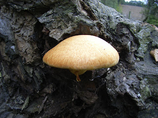
Passing lakes on the right, home to herons and ducks, we began the gentle climb up Camlet Hill. We made a slight detour north to see Camlet Moat, a 15th century island with a shallow moat where a drawbridge and weaponry dating from Roman times have been found. It's reputedly haunted, and is certainly eerie, not least because the algae covering the water makes the moat look like a road, and it would be easy to succumb to the water's depths on a dark night. The woodland surrounding the moat is rich in toadstools, including the fly agaric, easily recognisable to Noddy fans as Big Ears' home. We saw at least 10 varieties, enough for Noddy and Big Ears to climb the mushroom property ladder.

On exiting the wood, the path follows Salmon's Brook. The water still flows but is too shallow to harbour much in the way of fresh fish these days. The London Loop continues up Cuckolds Hill, but we took a detour north on a footpath alongside deeply ploughed fields to the Robin Hood in Botany Bay, a McMullens venue. More of a dining room than a pub, it was nonetheless homely and serves food from noon, making it a great spot for a late lunch (the carrot cake had long since worn off). It serves pub classics, plus a large chargrill and fish menu, platters to share and at least three hot vegetarian choices.

The Ridgeway which leads out of Botany Bay towards the outskirts of Enfield is the least attractive aspect of the walk, (nb you can catch bus 313 here to and from Potters Bar) as the road is busy, picking up the traffic turning into London from the M25 and the North Circular. But the ridge provides good views, with the television mast at Alexandra Palace and even the towers of Canary Wharf clearly visible to the south.

The road dips and climbs, and just beyond the Royal Chase hotel we rejoined the marked path, which heads north to Rectory Farm, home to some timid bullocks and friendly horses, and the red house, then under a railway bridge. You can extend the walk by heading north from St Johns church, but instead we opted for a leisurely pint in the quiet but welcoming Fallow Buck, and were treated by a couple of jays noisily flapping about in the trees opposite. We meandered through the estates to Gordon Hill train station for a short ride home, pitying the commuters surging out of London in the opposite direction. Pubs, walking and some urban wildlife - a perfect London day off.
Words and picture by Penny Woods

22 July 2010

What’s on the rocks?

Four miles of road walking. Doesn’t sound a great day out, but I’m not the only one trudging the tarmac along the Arisaig coast road. At each small bay and cove, people with cameras and binoculars peer expectantly out to sea. And with good reason … this is one of the UK’s otter hotspots.

The sun is shining – particularly fiercely for a Scottish May – and the sea lochs are shimmering, bright against the peaty brown headlands and islands. It’s a particularly fine stretch of coast, even set within the fierce competition of the west coast. And the tourists are flocking to this corner of the country – business in Mallaig has apparently boomed since the West Highland Railway started promoting day trips to the town from Fort William. The train journey through the highlands is rightly the major attraction, and with ninety minutes to kill in Mallaig (no easy task, I can tell you) they pack into the tea rooms and pubs.

After an hour of waiting, it’s clear the otters aren’t playing ball. Flask empty, newspaper fully browsed, I set off along the coast road again. At Millburn Cottage, I cross the stile and head along the deer tracks to Cruach Doire an Dobhrain, the high point of the Arisaig peninsula.

As summits go, it’s pretty modest – 103m. But the ground is rough going, with no tracks and plenty of heather. After an appreciative gaze at the Rois-Bhein hills to the south, and Rum and Eigg out at sea, I pick my way through the knee-high heather towards the coast, and the peninsula’s more reliable attraction – the remote bay of Port nam Murrach.

If this striking bay was on England’s south coast, it would have the full works – pubs, tea rooms, gift shops, overflowing car parks. Fortunately, it’s 40 minutes away from the nearest parking spot, which seems to be sufficient to keep most people away. Revelling in the solitude, I lie back on the sand and doze for an hour as the waves lap against the surrounding rocks. Balls to otters, this is the only way to spend a treasured sunny day in Scotland.

Returning via the cow-created track past Rhue Cottage, I get my wildlife spotter’s badge for the day – a buzzard circling over Cruach Doire an Dobhrain, with lapwings bobbling about in the nearby field. Heading back along the coastal road, several otter-spotters are still patiently sat by the shore; but for the furry beats are still proving elusive. I head past them towards my tent in Keppoch, via the restorative comforts of the café in Arisaig.

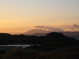
Even in May, Scottish evenings are long, and for those under canvas there’s little chance of sleep much before 11pm. But a long evening is no hardship when my campsite overlooks the islands of Skye and Rum. With the scarlet sun setting behind them, they looked perfect. If I was a Tweeter, I could have made lots of people envious at once, but as it was, I made do with a few texts before heading for the tent and the stove.

Eat and drink
Various cafes in Arisaig (although based on my experience, I would avoid the Rhu café). There’s also a small supermarket.

Sleep
several campsites around Keppoch – take the track past Keppoch house just north of Arisaig and follow the coast around to the campsites.

Getting there
Trains between Fort William and Mallaig stop at Arisaig, ten minutes from the village centre. There are also local buses that call at Arisaig.
Words and photos by Tim

5 February 2010

The lost village of Imber

We had finalised our plans the night before, sat in front of a blazing fireplace. Up early next day, quick cup of tea, then boots on and straight up on to Salisbury Plain, a ten-mile stomp and back home mid-morning for breakfast. This schedule would allow us to enjoy Wiltshire’s vast chalk plateau in near solitude, before the hordes of walkers, cyclists and rangers arrived. Hopefully we would see plenty of the wildlife that abounds on the lush, undisturbed grasslands and copses.

Standing outside at 6am on a freezing January morning, the flaws in our plan became apparent. My caffeine requirement correlates sharply with how early I rise, and the one cup of tea so far (cup, mind, not mug, and a smallish one at that) had barely raised a flicker on my internal motor. Danny, my walking companion for the day and someone I have long suspected to be of a much sturdier ilk, was thriving in the early morning darkness. Dermot the dog has unbounded energy at any hour, especially when there are rabbits about.

But our efforts paid off. Salisbury Plain is always a rewarding place for a walk, but it particularly inspiring at this early hour. The near-full moon shone brightly, illuminating the footpath, and the overhanging grasses tinkled as we crashed through their frost-covered seed heads. Soon we reached a barred gate that marks the perimeter of the army land. This is usually the point to turn left or right and head home via the outskirts of the plateau. But today, like a handful of other days each year, it marks the boundary of something a bit special. Our target was Imber, a deserted village right in the centre of Ministry of Defence land. They open it to the public for just a few days each year and this sense of something ‘forbidden’ makes it a popular trip.

As we had hoped, there was not another soul about. The ghostly outlines of discarded tanks on the hills around provided a reminder of the current land use, but as the first red-brick building appeared, we were reminded that this lonely outpost was once a thriving farming community. The building was the pub, the focus of village life until 1943. In November that year, the MOD told residents they would have to leave so that visiting American troops could practice street fighting. The villagers made this wartime sacrifice with no complaint, perhaps due to a promise that they could return post-war. But to this day, the village is devoid of residents and still used for army training. The only building still functioning is the church of St Giles, which holds services on ‘open’ days.

As we left the village, the preparations for a cycle race across the Plain were starting up, with the marshals putting out markers and generally making a lot of noise. We quickened our pace to keep ahead of them and avoid being coated in flying mud. A young deer family trotted briskly across the path in front of us; we stopped to watch them, only to have this scene of countryside idyll torn away by an expletive-laden instruction to, er, ‘go away’. Someone high up on the hillside had spotted the deer before us, and our disturbing presence had prevented a clean shot. Briefly, we considered exerting our right to be there; but he had one gun more than us. Argument settled. Comforted that we had, at least, spared the lives of the those gentle animals for another day, we hurried back to Edington for our sausages and bacon.

Getting there
Buses run to Edington, a village on the northern side of Salisbury Plain. You can also reach Imber from Warminster, which has a train station.

When to go
The outer parts of Salisbury Plain are accessible year-round, but Imber only on certain days around Christmas and New Year, Easter and the summer Bank Holidays. Check the Forever Imber website for more information.
For more photos of this walk, visit the Visitorreview page for Car Free Walks.